 Catalogue PIGMA
Transport networks
Type of resources
Available actions
Topics
Keywords
Contact for the resource
Provided by
Years
Formats
Representation types
Update frequencies
status
Scale
Resolution
-
Identified areas across the north Atlantic which have been flagged as priority locations for quality bathymetry data, in the context of expanded shipping traffic and port expansions. The reference to determine the priority survey areas in combination with shiping routes and port locations are the bathymetric data sources used for product 2( GEBCO, EMODnet bathymetry, USGS and CHS) and the depth uncertainty derived of Product 2. The adequacy assessment of the input characteristics of Product 3 is limited to the shiping routes and port locations.
-
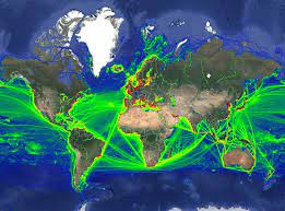
This data was obtained through a partnership with IMF, as part of IMF's World Seaborne Trade Monitoring System (Cerdeiro, Komaromi, Liu and Saeed, 2020). The data analysis was supported by the World Bank’s ESMAP and PROBLUE programs. The dataset contains 6 density layers, with vessel types aggregated to suit the needs of the WBG Offshore Wind Development Program: 1) Commercial ships 2) Fishing ships 3) Oil & Gas [note: this is just platforms, rigs, and FPSOs] 4) Passenger ships 5) Leisure vessels 6) GLOBAL ship density layers of all ship categories combined
-
-

Further information concerning the type of vessel can be available on request
-

-
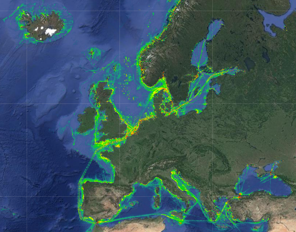
The Vessel Density maps in the EU were created in 2019 by Cogea for the European Marine Observation and Data Network (EMODnet). The dataset is updated every year and is available for viewing and download on EMODnet Human Activities web portal (www.emodnet-humanactivities.eu). The maps are based on AIS data yearly purchased from Collecte Localisation Satellites (CLS) and ORBCOMM. The maps, GeoTIFF format, show shipping density in 1x1km cells of a grid covering all EU waters and some neighbouring areas. Density is expressed as hours per square kilometre per month. The following ship types are available:0 Other, 1 Fishing, 2 Service, 3 Dredging or underwater ops, 4 Sailing, 5 Pleasure Craft, 6 High speed craft, 7 Tug and towing, 8 Passenger, 9 Cargo, 10 Tanker, 11 Military and Law Enforcement, 12 Unknown and All ship types. Data are available by month of year. Yearly averages are also available.
-

-
-
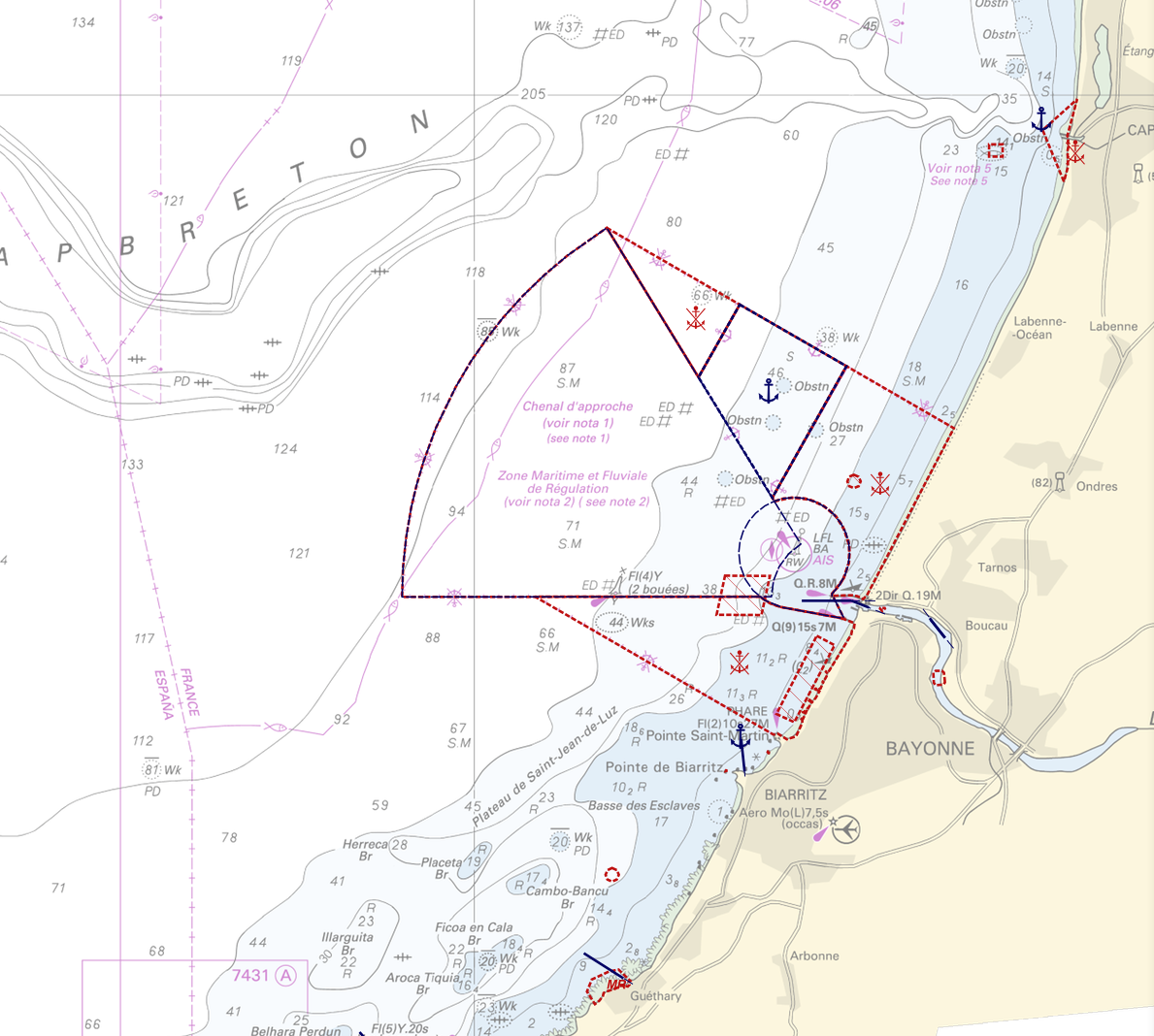
"Regulation - Navigation" product contains 18 object classes, the acronyms used are those of IHO standard S-57 - International Hydrographic Organization – (https://iho.int/): - Anchorage area (ACHARE): an area in which vessels anchor or may anchor. - Anchor berth (ACHBRT): a designated area of water where a single vessel, sea plane, etc. may anchor. - Administration Area (Named) (ADMARE) - Cable area (CBLARE) - Coastguard station (CGUSTA) - Cargo transhipment area (CTSARE) - Distance mark (DISMAR): mark indicating the distance on canals or rivers. - Dumping ground (DMPGRD): sea area where dredged material or other potentially more harmful material e.g. explosives, chemical waste, is deliberately deposited. - Fairway (FAIRWY): part of a river, harbour etc. where the main navigable channel for vessels of larger size lies. It is also the usual course followed by vessels entering or leaving harbours and sometimes called "ship channel". - Ice area (over land or water) (ICEARE) - Local magnetic anomaly (LOCMAG): anomaly of the magnetic field of the earth, extending over a relatively small area, due to local magnetic influences. - Marine farm/culture (MARCUL) - Navigation line (NAVLNE): a line generally passing through two clearly defined charted landmarks, and along part of which a vessel can approach safely. - Pipeline area (PIPARE) - Recommended track (RECTRC): track of undefined width, recommended to all or only certain vessels. - Restricted area (RESARE): specified area designated by an appropriate authority within which navigation is restricted in accordance with certain specified conditions. - Sea-plane landing area (SPLARE) Detailed definitions of each of these object classes can be found in the S-57 standard (https://iho.int/en/standards-and-specifications). An online catalog is available at http://www.s-57.com/. Some of the symbols used for display on data.shom.fr portal have been adapted from icons from the OpenSeaMap open library (https://github.com/OpenNauticalChart/). For reasons of readability, not all the characteristics of the objects are systematically displayed. All available information can be consulted by querying this layer.